Friday 2 December 2016

Sweet Falls


The hills of Meghalaya is blessed with many waterfalls and there are several waterfalls just within the capital city Shillong one of them is Sweet Falls, in Mawshbuit, East Khasi Hills, Meghalaya.

What is The Sweet Falls?

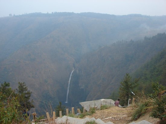
The Sweet Falls("Kshaid Weitden") is a waterfall in Mawshbuit near Happy Valley, not far away from the capital(about 9 km) and it takes about half an hour to reach there.

The waterfall can be seen from the viewpoint in Mawshbuit only, which it is far away from the fall and going to the foot of the fall is prohibited as it is also termed as "the most beautiful and most dangerous waterfall in Shillong" *.
Sweet Falls


Other than the magnificent view of the waterfall, the viewpoint in Mawshbuit has a calm environment, before reaching the viewpoint we are welcomed by pine trees and the locals are very friendly, the area itself is quiet and not very crowded. If you want to spend a quiet day and enjoy the view peacefully, then this viewpoint is exactly what you need to get away from the busy schedule of everyday life.
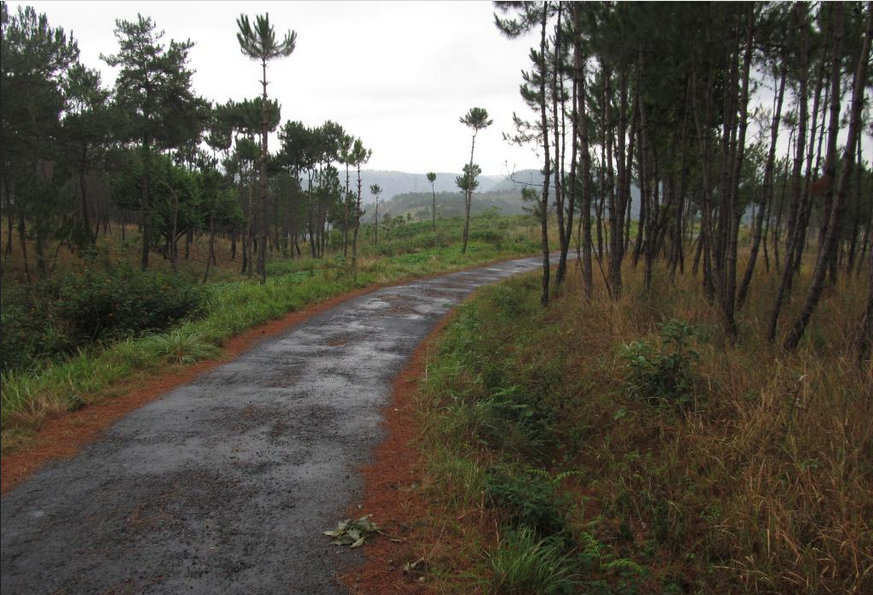
The Pine Trees before reaching the viewpoint

To get a closer look at the fall its good to bring along with you a good pair of binoculars and people do come to the viewpoint for a small picnic.

Getting to this tourist spot.

Sweet Falls Map
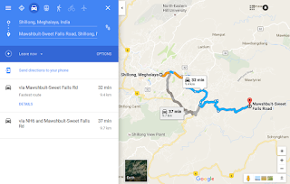
If your starting from Shillong then take the Old Jowai Road and head towards Nongthymmai, and on reaching Saw Lad Bus-Stop,turn left and head towards Happy Valley, move forward towards the Army Cantonment and and travel towards Mawshbuit Village.


Mawshbuit is also famous for the  Ever Living Museum, which consist of three components — the main museum, stone museum and a garden of wild orchids, wild flowers and wild fruits. A must visit if you want to know about the history and culture of Meghalaya. 


Further Links

Sweet Falls

https://www.tripadvisor.in/Attraction_Review-g503702-d2441193-Reviews-Sweet_Falls-Shillong_Meghalaya.html

* https://en.wikipedia.org/wiki/Sweet_Falls

http://www.walkthroughindia.com/attraction/top-9-most-beautiful-and-highest-waterfalls-of-meghalaya/

http://megtourism.gov.in/waterfalls.html

Ever Living Museum

http://northeasttourism.gov.in/evmuseum.html#sthash.jzWXsVLW.dpbs

https://www.tripadvisor.in/Attraction_Review-g503702-d10379943-Reviews-Ever_Living_Museum-Shillong_Meghalaya.html

Wednesday 30 November 2016

Laitlum Canyons

What is The Laitlum Canyons?

The Laitlum("End of the Hill") Canyons is a breathtaking landscape and a must visit site especially before noon as it is mostly covered with fog from noon onward and this definitely defines Meghalaya as being the home of the clouds. The last time we visited Laitlum was on October between 10 am and 2:00 pm and it was a clear day.
View from the edge of Laitlum

Located in East Khasi Hills, Shillong, Meghalaya, it's not only just a viewpoint but if you want to spend the whole day out there, then you better start early in the morning and take a 2 hours long trekking trip down towards the village below through the rocky trail and visit the people out there, just to think that they would have to climb up the steep hills daily is amazing. The trek back up would take minimum 3 hours provided you do it in the afternoon or when the humidity is low, as climbing up would be difficult and exhausting, so don't forget to wear comfortable clothes and carry refreshments for the upward trip.


This viewpoint is not widely known but in recent years its popularity had grown and with the release of the movie Rock On!! 2 which had a scene on this spot, people are now coming up to the meadow for a small picnic.
Entry to Laitlum is free and the community charges Rs 20 only for parking your vehicle, to help the village to maintain the cleanliness and the aesthetics of the area.

How to Reach Laitlum Canyons?


Map
Click to open Google Maps
Follow the Route on Google Map but for a better route its best if you go with a local person or someone who has been there.


Take MDR32 to NH6
15 min (4.4 km)


Take Smit Rd to Jongksha-Mawkynrew Rd.
37 min (16.5 km)


Drive to your destination
8 min (2.8 km)


More Pictures:

Laitlum Canyons View

Climbing up the steep hill


Further Links:

http://www.thebetterindia.com/60742/laitlum-canyons-meghalaya/

http://www.tourism-of-india.com/shillong/things-to-do/laitlum-canyons.html

http://sevendiary.com/panoramic-laitlum-canyons-meghalaya/

Hello World

Hello Everyone this is my first post on my blog, lets get started.


What is this blog all about?

Well  I'm  from Meghalaya("the abode of clouds"), a small state in North East India, yet filled with many beautiful waterfalls,  awesome caves, magnificent rivers,deep forests and many more natural sites, yet only a few knows about them and there are many more sites to be explored.

I being a programmer never thought that I would be captivated by the scenic beauty of Nature and yet now after visiting a few of them in the last few years, I have decided to write something about it and this blog's sole purpose is on The Nature and Beauty of Nature all around Meghalaya from my point of view, so what you will see and read about Meghalaya's Natural beauty is actually where I've been and would definitely like you to visit, because it's worth it.
Some Facts on Meghalaya:

Capital City: Shillong
Area:  22,429 Sq.Kms.
Natural sites includes Waterfalls, Caves, Rivers,Root Bridges, Valleys, Viewpoints, and more.